

We hear it on almost every demo call.
"We already have GIS."
Fair enough. A lot of systems do. Somebody usually an engineering firm, sometimes a state technical assistance provider set up an ArcGIS for you a few years back. There are dots on a map. Some lines. Maybe your hydrants and meters are in there.
So the question isn't whether you have GIS. The question is: who actually uses it?
The Map Belongs to the Engineer
At most small water systems, GIS lives in one of two places: on the engineer's desktop, or on a server nobody at the utility knows how to access. The engineer built the map. The engineer is the only one who can update it. And the engineer interacts with it maybe two or three times a year when there's a design project, a capital plan, or a grant application.
That's real work. Nobody's dismissing it. But engineering work isn't what runs a water system day to day.
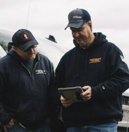
Running a water system is Monday morning. It's reading meters, exercising valves, flushing hydrants, responding to a leak, answering the phone when a customer calls about low pressure, then driving across town to check a pump station before lunch. That's the job. And the person doing that job, the operator, the one or two people who actually keep the water on, usually can't touch the map.
They can look at it, if they can even get to it. They can't add to it. They can't note that the valve on Third Street doesn't fully close. They can't flag that the main under Oak is only three feet deep and not bedded in cinders. They can't log a photo of a buried curb stop while they're standing right there looking at it.
All of that knowledge, the most valuable information your system has, stays in their heads, their truck notebooks, and a filing cabinet in the back office. The map stays frozen.
The People Who Need the Map Most Can't Write to It
Think about who actually needs accurate infrastructure data and when they need it.
The engineer needs it a few times a year. They use it to design projects, model hydraulics, plan capital improvements. When they need it, they need it to be precise. No argument there.
The operator needs it every single day. Two hundred and fifty days a year, minimum. They need it when they're looking for a valve they've never turned. They need it when a new hire is riding along and doesn't know the system yet. They need it at 3 AM when a main breaks and the person on call has to figure out which valve isolates the section — in the dark, in the rain, without calling the one guy who's had the job for 20 years.
And here's the thing about the 3 AM call. The information the operator needs isn't what the engineer put in the GIS. It's not the pipe diameter or the design flow rate. It's: where is the shutoff valve? Is it buried? Does it actually work? When's the last time somebody turned it? Is there a picture showing where it sits relative to the curb?
That's field knowledge. It's the stuff the operator knows because he's been there. And in the traditional GIS model, none of it gets captured because the map doesn't belong to him.
What "We Have GIS" Usually Means
We've done enough demos to know the pattern. When someone tells us they have GIS, we ask three questions:
When's the last time your field crew updated it?
The answer is almost always some version of: they don't. One superintendent told us, "All we really use it for is the location of where everything's at." They had ArcGIS or Diamondmaps. They keep paying for it. Their hydrants and meters were in there. But as far as putting in any work they've done repairs, valve exercises, condition notes; none of it went into the system.
Another utility had a GIS the city maintained for the whole municipality. The water plant didn't use it. The operator relied on plans and memory.
A third system had paper maps and a GIS that somebody set up years ago. The superintendent said he wasn't a tech guru and didn't know how to do anything with it.
Three different systems. Three different versions of the same story: dots on a map that nobody in the field touches.
Can your crew edit it from the field?
Usually not. Traditional GIS requires desktop software, a login, and at least some training to add or modify data. That's fine for an engineer who uses it as a design tool. It's a wall for an operator who's standing at a valve with muddy gloves and a phone in his pocket.
Does it track the work — not just the assets?
This is the biggest gap. Most GIS installations are a snapshot of what was designed or surveyed at one point in time. They don't track what happened since. They don't log work orders against specific assets. They don't attach photos. They don't build a maintenance history that someone can pull up two years later and say, "Oh, this is the valve we replaced the packing on in 2024."
A map that shows where things are but not what's happened to them is a reference document. It's not an operations record.
Maps Belong to the Field Now
Here's what's changed. GIS used to require a specialist. You needed training, expensive software, a desktop, and time. That kept the maps in the hands of engineers and GIS techs, not because they were gatekeeping on purpose, but because the tools required it.
That's not true anymore.
The operator walking his meter route can drop a pin on every meter he reads. The guy exercising valves can log the condition and snap a photo. The crew fixing a leak at midnight can tag the repair, note the depth, and the whole thing is on the map before they've finished backfilling the hole.
Every one of those actions makes the map more accurate. And the map gets smarter not because someone ran an engineering project, but because the field crew did their regular job. The people who know the system best are finally the people building the record.
That's not a technology upgrade. That's a shift in who controls the information. The maps belong to the field now — to the people who actually need them, who actually know what's in the ground, and who actually benefit when the data is right.
The engineer can still pull from the same map when they need to design a project. They get better data, actually, because the field crew has been maintaining it every day instead of letting it sit between projects.
But the map isn't for the engineer anymore. It's for the person at 3 AM who needs to know which valve to close.
Ready to put the map in your crew's hands? Start your free trial, see how it works, or check what it costs for your system.
Related reading:
You Don't Need Better GIS. You Need an Operations Record. →
The Map Gets Smarter Every Day — Or It Doesn't →
ESRI Is Overkill for Your Utility. Here's What to Use Instead. →
