One crew runs water, sewer, and streets for the whole town. Ziptility is built for the water and sewer half.
You run a small public works department. Water, sewer, and usually streets, parks, and a couple of trucks, all out of one shop with a handful of people. You wear five hats before lunch. The last thing you need is five separate software systems, each with its own login.
Most of a small department's emergency and compliance work lives in water and sewer. That is where Ziptility starts, and the streets question gets a straight answer below, not a promise.
What software do small public works departments use to manage water and sewer?
For a small department, the one that works is the one the crew will actually open in the truck.
A map-first app with the water and sewer assets built in, one you run yourself with the crew you already have, and one price for the whole crew instead of a per-seat license.
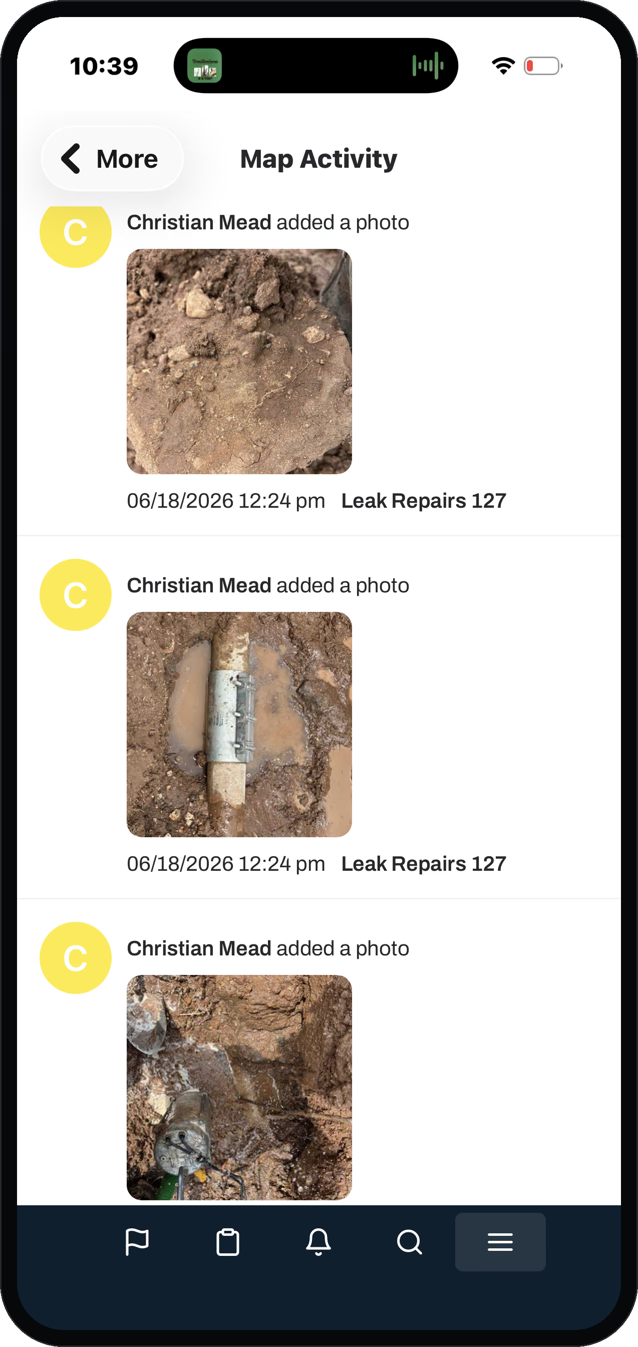
Most small departments have a roll of paper maps, a billing program in the office, and one veteran who knows where the valves are buried. Every main, valve, hydrant, meter, service, manhole, lift station, and line becomes a point you can tap. Pull it up and you see the whole record: size, material, when it went in, every repair, who touched it last. It stays current because the work rides on the asset. When the crew fixes a valve, they fix it on the valve, so the history writes itself, no second system to update. That is asset management, the map, and work orders in one app, covering the work a small department lives and dies by:
- Water distribution: mains, service lines, curb stops, customer meters, valves, fire hydrants
- Sources and storage: wells, pumps, booster stations, storage tanks
- Sewer collection: gravity mains, force mains, manholes, cleanouts, lift stations, grinder pumps
- Events you need on the record but that are not rate-base assets: main breaks, SSOs, sewer backups
He had a map his city engineer built, but no way to update it himself.
A public works director, on why the record kept dying between engineer visits.
That is the gap this closes. The crew keeps the record current, and the engineer stays the engineer.
Is there an all-in-one public works system for a small city covering water, sewer, and streets?
We are all-in-one for the work a small water and sewer department runs, and honest about the streets boundary.
There are whole-city systems that try to cover roads, parks, fleet, buildings, and water all at once. We are not that, on purpose.
Here is the line, stated plainly so it never trips you up in a demo. We are strong on water and sewer. We are not a full street, pavement, sign, or fleet management system, and we will not pretend to be. What we handle on the streets side is the work that spills out of a water or sewer job. A service line breaks, the crew digs it up, and the repair spawns the follow-up: pavement restoration, sidewalk restoration, landscaping restoration, the damage claim. Those are tracked as the child tasks they are, tied to the dig that caused them, with the photo and the cost attached. Follow-up off a dig, not a standalone streets program.
Weighing a whole-city suite? See our honest reads: Ziptility vs Cartegraph (OpenGov) and Ziptility vs Cityworks.
What does it take to run public works asset software yourself?
Less than the big systems have taught you to expect.
Ziptility is built so a small department runs it with the crew it already has. There is no city-sized system to stand up and nothing to administer.
A whole-government suite is a system somebody has to run full time. Ziptility starts from the map or the meter-read list you already have: we drop your assets onto the map, and the crew refines them in place as they work. Up and running in hours, not months. It is also how a small department adopts software, from the bottom up. A water superintendent gets it working, the crew leader sees it, and the streets and sewer side asks to log their work in the same app.
What is the most affordable public works software with GIS and asset tracking built in?
The most affordable one for a small department does not charge per seat.
Ziptility is priced by service connections, one yearly fee, with the whole crew included. You are not counting heads or buying licenses for the field techs.
This matters because field-first only works if the field actually has it. When the price punishes you for adding the third operator, the app ends up on one office computer and the crew is back on paper. Pricing by connections puts it on every phone for no extra charge, so the record gets fed by the people doing the work. (See pricing for how the connection-based fee works for a department your size.)
Which public works asset software has the easiest interface for field crews?
The easiest one is designed for a thumb and a phone standing in front of the asset, not a desktop built for a planner.
If the crew cannot open it in the truck, log the work in under a minute, and move on, it failed.
Small-department work is reactive and physical: a main break, a valve exercise, a manhole inspection, a service-line dig, a meter swap. The crew pulls up the asset, logs what they did, snaps a photo, and gets to the next call. We have heard the alternative described plenty. A cumbersome field app, crews give up on it, carry the paper route sheet back to the office, and key it in at the desktop. That is the failure we designed against. (A large regional operator described that exact paper-back-to-the-desktop habit on a call with us, 2026-06-18.)
Does your billing software's map count as a field system?
No. A map bolted onto a billing program is built for the clerk's office, not the crew.
It does not hold the maintenance history, the valve turn counts, or the true cost of a repair.
A lot of small cities have a billing or ERP program with a map bolted on. It was sold to the clerk or finance office. Programs like Tyler, gWorks, and similar billing-side tools add a map for the office. That is a billing add-on, not a maintenance system. The clerk's map does not give your crew the valve's turn count, the hydrant's last flow test, the main break on that block last winter, or the true cost of the repair. If your billing system has a map, keep it for billing. Put the field on something the field will use.
That same record also makes your case to the council. Closing a job rolls its parts, equipment, and labor onto the asset. The record the crew builds day to day is the one that backs a rate increase or a funding application. You walk in with the numbers, dated and from the field. The board argues with the math instead of with you. (See financial tracking for the capital-planning side.)
- Built for the crew, in the truck
- The valve's turn count
- The hydrant's last flow test
- The main break on that block last winter
- Parts, equipment and labor rolled onto the asset
- Built for the clerk's office
- Sold to the clerk or finance
- No maintenance history
- No true cost of a repair
- Fine for billing. Keep it for billing.
Where to go from here
Each piece of the system has its own page. Follow the one you need next.
Questions operators ask
What software do small public works departments use to manage water and sewer?
A map-first app with the water and sewer assets built in, one you run yourself with the crew you already have, and one price for the whole crew. Ziptility puts the map, the work orders, and the asset history in one place the crew runs from a phone.
Is there an all-in-one public works system for a small city with water, sewer, and streets?
Ziptility is all-in-one for water and sewer, the work most small departments live on. We are not a full street, pavement, or fleet system. We do handle the streets work that spills off a dig, like pavement and sidewalk restoration and damage claims, tracked as follow-up to the water or sewer job that caused it.
What does it take to run public works asset software yourself?
Not much. There is no city-sized system to stand up and nothing to administer. You start from the map or meter list you already have and refine it in the field, up and running in hours.
What is the most affordable public works software with GIS and asset tracking built in?
The one with no per-seat fee. Ziptility is priced by service connections, one yearly fee, with the whole crew included, so the field techs do not cost extra and the map gets fed by the people doing the work.
Which public works asset software has the easiest interface for field crews?
The one designed for a phone in the field, not a desktop. The crew taps the asset, logs the work, snaps a photo, and moves on. The record updates without a trip back to the office.